August 25, 2010
Longyearbyen


Flower Correction
Back at home, Inger was able to more closely analyse the samples we took under a dissecting microscope in the lab. The beautiful flowering sample we saw was in fact Potentilla x insularis, but a smaller plant was the Potentilla nivea ssp. Nivea that we were looking for.

August 11, 2010
Safely Home

August 8, 2010
Arctic Stonehenge?

Whilst out searching the tundra for a tasty evening snack - to be honest I'm not a fan of the chocolate cookies that Allen likes so much - I came across a large area of these strange rock circles and wondered how they got here. Was it the holy site of an ancient tribe? The footprints left by extraterrestrial visitors?
In fact these landforms are completely natural and are produced by the annual cycles of freeze and thaw that take place in the arctic soil, which lift larger rocks to the surface then push them outwards until they gather in rings. I also found these distinct stripes which form by a similar process on shallow slopes.

Turning Botanist
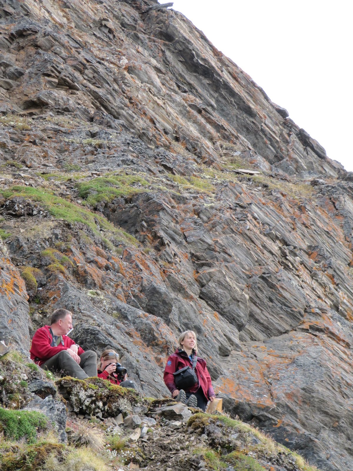
Our mission was to find a particular kind of Potentilla - basically an Arctic buttercup. The trick (of course there was a trick!) was that there are four very similar varieties of this plant in the Kongsfjorden area. We were looking for the ones with plain yellow flowers (no spots), and short white hairs on the underside of their 3-lobed leaves.
Inger led us to the right spot, and we struck lucky finding three patches of plants showing a range of flowers in bloom and dying! Mission achieved!

Gareth, Fiona, and Inger relaxing for a second after finding the flowers. The flowers like to grow on steep slopes - steep enough to catch strong sun and deter grazers but shallow enough to hold on to soil.
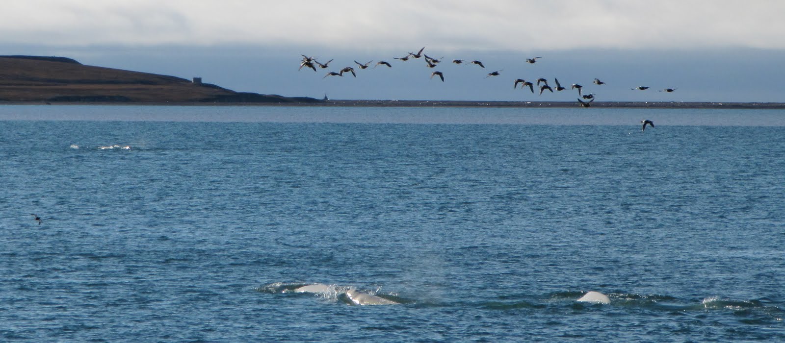
Although Ossian Sars is an island, reindeer and foxes cross over (mostly in the winter, but some swim in the summer, too). We saw a very cute little Arctic fox, but he was too quick for my camera. A reindeer below us, on the other hand, very obligingly stood near an iceberg in the ocean below.

I tried to convince the others that I could identify plants by taste, but was told off because it destroyed the (tasty) samples. It was very hard for me to not eat the flowers, but I did my best...

Inger maintains a very comprehensive website about all of Svalbard's vascular plants - check it out at www.svalbardflora.net. The photos from our trip on Thursday should be up in a couple weeks once DNA tests confirm the flower identification.
August 7, 2010
Newswatch

If you were thinking that we're the only team doing cool research in Ny-Ålesund, then (although we might be flattered) you'd be wrong. Here's a cool article (Looking for the Coolest forms of Life on Earth) from ScienceDaily about a team of UK scientists using glaciers in the area to simulate what conditions life might have to deal with on Mars. They're even keeping a blog, so if you need your Ny-Alesund fix after we're gone, you can get it here.
August 6, 2010
Breaking News: Fjord goes for a run

We have it on good authority that the shoes in the background belong to none other than grad student Allen Pope training on the rowing machine.
Tour of Ny-Ålesund
Here is Ny-Ålesund from the plane as we flew in. The long, thin building on the bottom right is the Norwegian Sverdrup Stasjonen, the gray/black building cut off on the right side is the main King’s Bay building with the dining hall and common spaces, the red building next to that hosts the French and Korean stations, and the blue building in the middle is the German station.

Down the road are the post office, the ‘Samfunshuset’ where Jon and I have our rooms (and the gym and sauna are located), the Indian station, the UK station, the Dutch station, the bar, and eventually the port where tourist ships stop in with some frequency.
The Chinese station has two (very distinctive) stone lions out front. Fjord couldn’t quite overcome the reindeer-lion language barrier.

There is a large statue of Roald Amundsen in the centre of town (with a quite distinctive nose), commemorating his polar exploration and in particular his flight in an airship from Ny-Ålseund over the North Pole. Conveniently, it is right next to the Norwegian station which is in the background.

The Ny-Ålesund post office is a much-photographed location.

And the shop (or butikken in Norwegian) has a large range of souvenirs (mostly for tourists, but also for residents) as well as snacks and the liquor store (which, like all liquor on Svalbard is rationed because of very, very low tax levels – beer here costs one third of what it does on the mainland!).

As the settlement used to be a coal mine, they needed to move the coal around. As a remnant – here’s a random train in town.

The port receives the high volume of tourists that pass through as they briefly get off their cruise ships to see the station. Fjord likes it down there – evidently the rescue ring is a good place to rest.

Right next to the large quay is the harbor where the small research boats (for getting around Kongsfjorden and slightly beyond) are located. In the background you can see the Marine Laboratory, a first rate facility for all research having to do with the ocean.

I hope you’ve enjoyed the little photo tour. It’s a small place, but there’s a lot in it. Too much for one blog post. You’ll just have to come here some time to see it yourselves!
August 4, 2010
What is the similarity between glacier ice and broccoli?

They both exhibit self-similarity; when viewed at different scales they appear the same, so that the whole surface is made up of a number of smaller versions of itself as can be seen by this striking photo of Romanesco broccoli.
This property has important implications for measuring the roughness of a glacier's surface, which fjord has been helping Jon to do on Mitdre Lovénbreen. The roughness measured will depend on the scale of measurement; to an extent the larger the scale over which the roughness is measured, the rougher the surface will appear to be.
Fjord has been helping Jon make measurements using two methods, each at a different scale. The first method, at a scale of 15m, involves measuring the distance to the surface along the length of a fixed horizontal length of cord.

The second method measures at a smaller scale of 1 metre, and is much quicker. Here fjord pushes a black metal plate vertically down into the surface. A photo of the plate will show the outline of the glacier surface along the line of the plate, contrasted against the black plate. Using image processing software the photo can be turned into an accurate representation of the surface roughness. Fjord prefers this method as it is much quicker.

Roughness is an important surface characteristic because its affect on the flow of air over the glacier surface influences the amount of heat transferred between the ice and the atmosphere and also because it is seen as "texture" in aerial and satellite imagery.
August 3, 2010


Fjord learns to measure snow
Grain size is really easy to measure – we scoop some grains up onto a card with 1 mm, 2 mm, and 3mm grids on it and see (with the help of a little magnifier) how big the grains are. Fjord says these were ~1mm.

Snow density is another very simple thing to measure with the right tools. Fjord demonstrates quite well here. First, you push a metal wedge (of known size!) into the snow, collecting the surface layer.

Then, when the shovel is full, you slide a cover over it so that the wedge is completely full.

You end up with a sample like this…
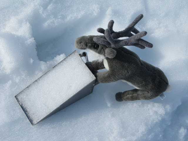
Which we now weigh…

Once we have a known size and a known mass, we can calculate snow density (density = mass / volume)!
With the help of this data we’ve already noticed that small grain size scatter light more efficiently and provide higher reflectance than coarse grains across all wavelengths!
August 2, 2010
Amundsen's Mast

Fjord and Amundsen in the centre of Ny Ålesund
In the centre of Ny Ålesund, the bust of Roald Amundsen looks into the distance, not north or south, the directions which he faced for much of his life, but eastwards towards an old mast on the tundra just outside the station. It was from here in May 1926, that Amundsen, with 8 Norwegians, 6 Italians and an American, flew the airship Norge over the North Pole to Teller, Alaska, and became the first to reach both geographic poles, along with Oscar Wisting, who had accompanied him to the South Pole.

Amundsen's mast with Kongsfjorden behind
Amundsen had made an attempt using aeroplanes the year before, but was forced to land on the ice at 87º north and the party of 6 then had to build a runway over the pack ice on starvation rations in order to fly the one working plane, the N-25, back to Ny Ålesund.
In 1928 the Italian Umberto Nobile, who had designed and then piloted the Norge, was attempting to reach the pole again, with an Italian crew. The Italia had reached the pole and was returning to
Shrinking glacier

When Gareth was last in Ny Ålesund, he and a colleague used a technique called airborne LiDAR to make a very detailed map of the surface of Midre Lovénbreen. The snout (lower edge) of the glacier was very clearly visible in that map. We revisited the snout area a few days ago and remapped it by the very simple (but rather muddy) method of walking along it once in each direction, recording our location as we went using a GPS receiver. This showed that the snout has melted back by about 50 metres in the five years since we last looked at it.
Kongsfjorden Kruise
Step 1: Survival Suits (in case we fall in...)

Step 2: Capture beautiful view of Midtre Lovénbreen

This is Fiona - one of the station managers of the Norwegian research base and also one of Gareth's former PhD students.

And now some scenic shots of birds, glaciers, mountains, a failed marble mine, and more...


Now to finish off with some sounds, too. Here, you can see the front of Kongsvegen and hear the clunnks of lots of little icebergs against the bottom of the boat.
And here, there is an outflow of water underneath the glacier. It stirs up sediment and plankton so the birds congregate to feed. Quite a scenic spot for a meal!